
Dosye:Africa-countries-northern.png
Taa üüksek aydınnıklı versiya bulunmêêr.
Africa-countries-northern.png (360 × 392 piksel, fayl ölçüsü: 10 KB, MIME tipi: image/png)
| Bu dosya Wikimedia Commons'da kullanılıyor . Dosyanın açıklaması aşağıdadır.
|

|
File:Africa-countries-northern.svg, bu dosyanın vektör versiyonudur. Aşağı olmadığında bu raster görüntünün yerine kullanılmalıdır.
File:Africa-countries-northern.png → File:Africa-countries-northern.svg
Daha fazla bilgi için Help:SVG/tr sayfasına bakın. |
 |
Özet
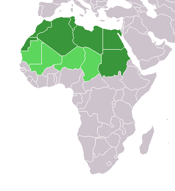
English: Map of countries in geo-political North Africa — as considered by the U.N.
- Credits
from en:Image:Africa-countries-northern.png

|
Bu belgenin GNU Özgür Belgeleme Lisansı, Sürüm 1.2 veya Özgür Yazılım Vakfı tarafından yayımlanan sonraki herhangi bir sürüm şartları altında bu belgenin kopyalanması, dağıtılması ve/veya değiştirilmesi için izin verilmiştir;
Değişmeyen Bölümler, Ön Kapak Metinleri ve Arka Kapak Metinleri yoktur. Lisansın bir kopyası GNU Özgür Belgeleme Lisansı sayfasında yer almaktadır. |
| Bu dosya, Creative Commons Atıf-Benzer Paylaşım 3.0 Taşınmamış lisansı ile lisanslanmıştır | ||
| ||
| Bu lisanslama etiketi, dosyaya GFDL lisanslama güncelleştirmenin bir parçası olarak eklenmiştir. |
Fayl istoriyası
Fayl istoriyasın görmää deyni Gün/Zaman bölümündeki dataları tıklayınız.
| Gün/Zaman | Küçük resim | Masştablar | Kullanıcı | Kommentariya | |
|---|---|---|---|---|---|
| Şindiki | 18.22, 17 Baba Marta 2018 | | 360 × 392 (10 KB) | Maphobbyist | Montenegro border |
| 00.00, 1 Çiçek ay 2016 |  | 360 × 392 (10 KB) | Fry1989 | Reverted to version as of 16:12, 13 January 2014 (UTC) | |
| 12.37, 7 Kasım 2015 |  | 360 × 392 (10 KB) | Hpyounes | correction | |
| 19.12, 13 Büük ay 2014 |  | 360 × 392 (10 KB) | VVVF | See http://unstats.un.org/unsd/methods/m49/m49regin.htm | |
| 18.59, 13 Büük ay 2014 |  | 360 × 392 (13 KB) | VVVF | Reverted to version as of 20:15, 9 July 2011. See http://unstats.un.org/unsd/methods/m49/m49regin.htm | |
| 15.47, 20 Orak ay 2011 |  | 360 × 392 (7 KB) | Kahusi | See http://unstats.un.org/unsd/methods/m49/m49regin.htm | |
| 23.15, 9 Orak ay 2011 |  | 360 × 392 (13 KB) | Maphobbyist | South Sudan has become independent on July 9, 2011. Sudan and South Sudan are shown with the new international border between them. | |
| 14.13, 5 Hederlez 2006 |  | 360 × 392 (4 KB) | Hautala | optimized with png | |
| 19.30, 20 Çiçek ay 2005 |  | 360 × 392 (14 KB) | Yonghokim | map of countries in Northern Africa. from en:Image:Africa-countries-northern.png {{GFDL}} |
Mediya faylına baalantı
Yok sayfalar ani bu fayla baalı.
Küresel dosya kullanımı
Aşağıdaki diğer vikiler bu dosyayı kullanır:
- ce.wikipedia.org üzerinde kullanımı
- es.wikipedia.org üzerinde kullanımı
- fr.wikipedia.org üzerinde kullanımı
- he.wikipedia.org üzerinde kullanımı
- ru.wikipedia.org üzerinde kullanımı
- sc.wikipedia.org üzerinde kullanımı
- sv.wikinews.org üzerinde kullanımı